
")
Table of contents
How to Use the Calgary Real Estate Map for Effective Home Searches
If you’re thinking about moving to Calgary, one of the best ways to start your home search is by exploring the city through a Calgary real estate map. Calgary is a diverse, dynamic city made up of unique quadrants, each with its own lifestyle, housing styles, and price points. Whether you’re drawn to the mountain views in the west, the family focused communities in the north, or the modern urban condos downtown, using a real estate map can help you visualize your options and make confident, informed decisions.
A map based approach is especially helpful if you’re new to the city. It allows you to see how different neighborhoods connect, where schools and amenities are located, and how your commute or lifestyle preferences might align with certain areas. Instead of scrolling through endless property listings, a Calgary property map helps you search smarter, not harder.
Understanding the Calgary Real Estate Map
A Calgary real estate map is an interactive digital tool that allows you to browse homes for sale based on location. Rather than typing in addresses or searching by price alone, you can visually explore the city to see exactly where listings are located. Most online real estate platforms, including MLS®-based searches, feature an integrated map function that updates in real time as new homes come on the market.
This approach provides far more context than a standard list of homes. For example, if you know you want to live close to Glenmore Reservoir, Nose Hill Park, or a specific CTrain line, you can zoom in to those areas and instantly see active listings nearby. It’s a practical, visual way to get a feel for Calgary’s geography and to narrow down your home search based on lifestyle rather than just price.
What is a Real Estate Map Calgary?
When you hear the term “real estate map Calgary,” it typically refers to online mapping tools that integrate property listings, city boundaries, and local features into one interactive view. You can use these maps on real estate websites, such as CIR Realty or CREB®, or even third-party listing platforms that display Calgary’s residential zones, communities, and property types.
The advantage of a real estate map is that it shows you more than just homes; it shows you how those homes fit within the bigger picture. You can easily compare prices between districts, check how far schools are from your desired neighborhood, and identify where new developments are taking shape.
Benefits of Using a Calgary Property Map
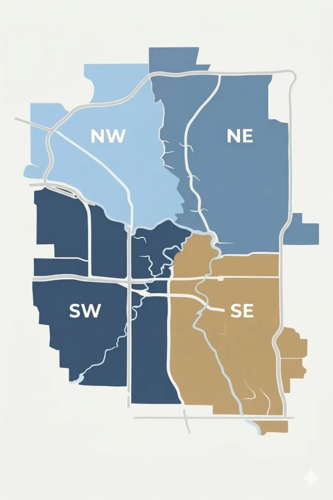
A Calgary property map offers multiple advantages for anyone considering a move to the city. First, it provides clarity. Calgary is divided into four main quadrants: NW, NE, SW, and SE. Each containing dozens of unique neighborhoods. Seeing these areas mapped out helps you understand where communities sit in relation to downtown, major highways, or the mountains.
Second, it helps you make data driven decisions. By toggling different filters, you can track price ranges, home types, and days on market, giving you insight into which areas are most active or within your budget.
Finally, using a map helps you balance your priorities. For example, if your dream is a walkable community near parks and restaurants, you might gravitate toward areas like Kensington or Marda Loop. If you prefer quiet streets and larger lots, you might look in Discovery Ridge, Tuscany, or Mahogany. The map lets you see all these options side by side, so you can compare and decide what fits your lifestyle best.
Features of the Calgary Real Estate Map
Modern Calgary real estate maps are highly interactive. You can zoom in or out, click on specific homes to view photos and details, and even toggle between different map styles such as satellite, terrain, or street view. Many platforms also allow you to draw custom shapes around areas of interest, so you can receive alerts when new homes hit the market in your chosen zone.
Some advanced maps also integrate demographic or zoning data, letting you explore property trends, school catchment areas, and future development plans. This feature is particularly useful if you’re relocating from another province and want to get a sense of where family friendly amenities or investment opportunities might be strongest.
Search Filters and Customization
One of the greatest strengths of a Calgary real estate map is its ability to personalize your search. You can filter results by property type (detached, semi-detached, condo, townhouse), price range, number of bedrooms, or even lot size. You can also specify whether you’re looking for newly built homes, properties with suites, or listings with specific features like garages or finished basements.
Customization helps you focus only on homes that fit your priorities. For example, if you’re moving to Calgary from Ontario and want a family home with nearby schools and parks, you can set filters for 3+ bedrooms, within a certain price range, and zoom into school districts in communities such as Evanston, Auburn Bay, or West Springs.
User Friendly Interface and Navigation
Most Calgary real estate maps are designed to be intuitive, even for first time users. When you move your cursor over a listing, you’ll see quick highlights: price, address, square footage, and photos. Clicking opens the full listing, where you can view details like year built, MLS® number, and neighborhood features.
The navigation tools make it easy to switch between listings and map views, helping you keep track of your favourites. You can even set up saved searches that email you when new listings appear in your chosen area, ensuring you don’t miss out on opportunities in a fast moving market.
How to Navigate the Calgary Neighborhoods Map
Calgary’s neighborhoods are grouped by quadrant, and understanding these regions is key to finding your ideal community.
The Northwest (NW) quadrant offers stunning mountain views and quick access to outdoor recreation. Communities like Tuscany, Rocky Ridge, and Scenic Acres are family favourites with excellent schools and parks.
The Northeast (NE) is known for cultural diversity and proximity to the airport, with affordable housing in areas like Saddleridge and Skyview Ranch.
The Southwest (SW) quadrant includes luxury communities such as Discovery Ridge, Aspen Woods, and Springbank Hill, while also offering established family areas like Signal Hill and Lakeview.
The Southeast (SE) is one of Calgary’s fastest growing regions, featuring modern master planned neighborhoods such as Mahogany and Seton, both designed with lakes, restaurants, and recreation at your doorstep.
Exploring these areas on a Calgary neighborhoods map allows you to visually compare communities, distances, and features; helping you pinpoint where you’ll feel most at home.
Identifying Local Amenities and Schools
A Calgary real estate map often integrates nearby amenities, including grocery stores, parks, and transit routes. Some maps even display school locations, so you can assess which communities align with your family’s educational needs. This is especially helpful when considering popular school systems like the Calgary Board of Education (CBE), Calgary Catholic School District (CCSD), or French immersion programs.
If you’re relocating with children, look for areas with high-ranking schools or access to extracurricular programs. By using the map, you can see how close these facilities are to prospective homes; an important factor for daily routines and long term satisfaction.
Tips for Effective Home Searches
To make the most of your Calgary real estate map, start by clarifying your top priorities. Are you looking for proximity to work, good schools, or outdoor recreation? Once you know what matters most, use map filters to focus your search on those criteria.
Next, monitor trends. Calgary’s housing market changes quickly, so check regularly for new listings and price adjustments. Set up alerts to stay ahead of other buyers in competitive areas.
Lastly, don’t rely solely on online exploration. Use the map to shortlist communities, then visit them in person; or connect with a local REALTOR® who can provide insights about schools, commute times, and neighborhood character that aren’t always apparent online.
Utilizing Tools for Location Insights
Beyond property listings, many real estate maps include helpful data layers such as walkability scores, public transportation routes, and neighborhood demographics. These insights help you understand not only what’s for sale, but what day to day life might feel like in that area.
For example, a walkability score can tell you whether you can run errands on foot, while transit overlays can show which communities are best for commuting downtown. If lifestyle and convenience are priorities, these tools will help you find the right fit.
Conclusion: Your Map to a New Life in Calgary
Using a Calgary real estate map is one of the smartest ways to begin your home search. It’s visual, intuitive, and packed with insights that can help you choose not only a house, but a community that matches your lifestyle.
By exploring Calgary’s neighborhoods through an interactive map, you’ll quickly see how diverse and exciting this city truly is: from the lakeside charm of Mahogany to the foothill beauty of Discovery Ridge.
If you’re planning a move to Calgary and want help narrowing your search, I’d love to guide you through the process. As a local REALTOR® with deep knowledge of Calgary’s communities, I can help you explore neighborhoods, understand market trends, and find a home that fits your goals.
Let’s make your move to Calgary the right one; together.
Frequently Asked Questions
A property map provides a visual way to understand the layout of Calgary’s communities. It helps you compare neighbourhoods, view proximity to amenities, and identify areas that match your lifestyle and budget. It’s especially useful for people relocating to Calgary who may not be familiar with the city’s layout.
Most MLS®-based real estate maps update frequently, sometimes every few minutes, to reflect new listings, price changes, and sold properties. This ensures you’re seeing the most accurate and up to date information available.
Absolutely. You can zoom in on neighbourhoods like Mahogany, Evanston, or Discovery Ridge, or even draw a custom boundary to focus on specific streets or communities. This is a great way to narrow your search to areas that fit your preferences.
Some platforms include zoning and development overlays, which highlight areas planned for new construction or redevelopment. This can be valuable for buyers looking for future growth potential or investment opportunities.
Begin by exploring each quadrant: NW, NE, SW, and SE, to understand Calgary’s layout. Use filters to match your budget and property type, then compare amenities and commuting distances. A local REALTOR® can also help interpret the map’s data and guide you toward the communities that best suit your goals.
While maps are excellent tools for browsing listings, a REALTOR® offers insight that data alone can’t provide: such as local market trends, resale potential, and community nuances. They can help you interpret what you see on the map and ensure you make informed decisions.
If you’re planning to move to Calgary, reach out to a local expert like Shelley Munnings with CIR Realty. Shelley can help you use the Calgary real estate map effectively, explain the pros and cons of each neighbourhood, and guide you every step of the way toward finding your new home.